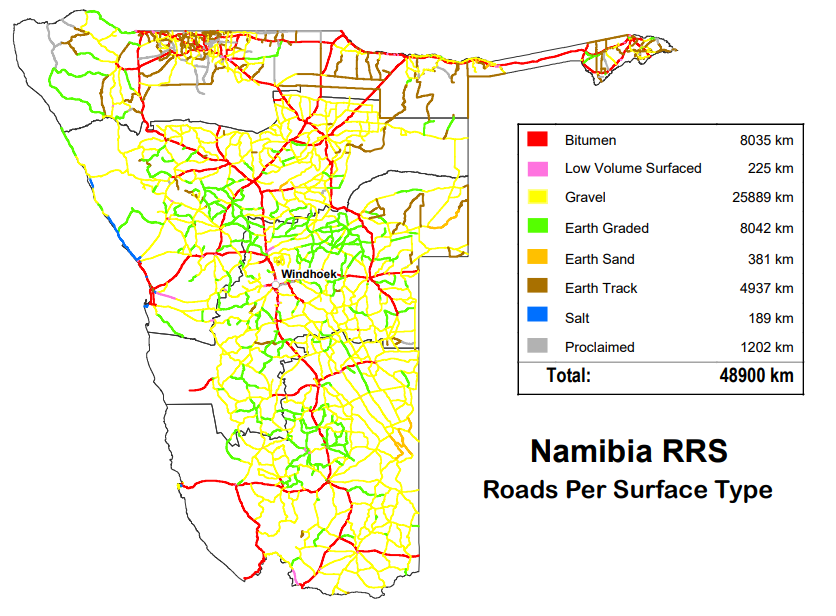
The custodian of the road network on behalf of the Government is the Roads Authority of Namibia. All proclamations and data regarding the road network are deposited in the data base of the RMS. Maps based on Network 6 for Namibia and District have been completed and distributed to all regional offices and head office personnel, including stakeholders.
The past year saw many developments changing the road network statistics, moving from crude data to more advanced and accurate data perfecting the accuracy level of the road network. These developments require changes in the databases for strategic reports and planning. Many of these changes have been recorded on Network 7 that is due to be published in the first quarter of 2010-2011.
The RMS regards capacity building as an important aspect of development within the organisation. The entire RMS Technical team did the first two courses on ArcGIS. Final training will follow in April/May 2010.

The Bridge Management System
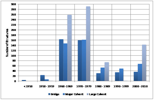
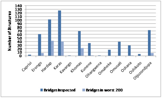
For the first time in the history of the former Department of Transport and the RA, a visual assessment of 499 Bridges, 953 Major Culverts (953) and 1 303 Culverts was done in 2008, giving the conditions of the bridges and budgetary requirements. The RMS has prepared an executive summary on the Bridge Management System, which was discussed with all internal stakeholders and accepted by them. Various presentations were also done internally and externally. The recommendations were passed on to the NP&C Division for the detail investigation of the 200 bridges in the worst condition, and to Maintenance Division for their routine maintenance budgeting and priorities determination.
The annual budget for a five-year period as calculated by the BMS comes to: Routine Maintenance, N$8 100 000; Repairs N$12 300 000; Total N$20 400 000. Currently, only a fraction of this amount is spent on bridges due to lack of sufficient fund availability. Figures below provide statistics of the age distribution and condition of Namibia's different structures distributed across the Political Regions. As can be seen, the most structures are in the Karas region, followed by Hardap. Ohangwena and Kavango regions have the lowest number of structures.